
LiDAR surveying of terrain, buildings and infrastructure
Our LiDAR scanner captures dense 3D point clouds of terrain, buildings and infrastructure. Georeferenced data supports surveying, design, BIM modelling, volume calculations and existing-condition analysis.

3D point clouds for planning and construction
Airborne LiDAR surveying
The scanner emits laser pulses and measures distances to surfaces, producing dense point clouds of terrain, buildings and infrastructure. Pulses passing through gaps in vegetation may provide ground data. LiDAR does not penetrate opaque materials; results depend on the asset and conditions.
When is LiDAR useful?
LiDAR is useful where detailed spatial data is required:
- Terrain and infrastructure surveys
- DTM and DSM generation
- Building and industrial documentation
- Planning and BIM inputs
- Linear infrastructure corridors
- Forested and vegetated areas
- Stockpile volume calculations
The LiDAR survey process
- Agree the area, accuracy, coordinate system, formats and required permissions.
- Capture data using a drone-mounted LiDAR scanner with RTK support.
- Process measurements into a 3D point cloud.
- Prepare agreed models and deliverables.
Your deliverables
According to the agreed scope:
- LAS, LAZ or E57 point clouds
- DTM and DSM models
- Elevation data
- CAD and GIS data
- Orthophotos from additional imagery
Formats are matched to your software. BIM model production is agreed separately.
Your deliverables
Design teams, engineers, contractors and infrastructure operators can use the data for:
- Terrain profile analysis
- Building modelling
- Planning base data
- Volume calculations
- Infrastructure documentation
- Terrain change comparisons
Benefits of LiDAR surveying
Efficient data capture
Large areas can be captured efficiently from the air, subject to flight conditions and terrain visibility.
Terrain capture beneath vegetation
Some pulses reach the ground through gaps in vegetation, allowing terrain reconstruction where sufficient ground returns are recorded.
High data density
Millions of measured points create a detailed 3D record. Data is prepared for agreed CAD, GIS and BIM workflows.
Capture hard-to-reach areas
Slopes, roofs and infrastructure can be surveyed from the air, reducing the need to enter difficult terrain.
Related surveying services
Related services

Drone surveying
Georeferenced drone survey data for land, buildings and infrastructure.

Building documentation
Structured imagery, measurements and 3D data documenting building condition.
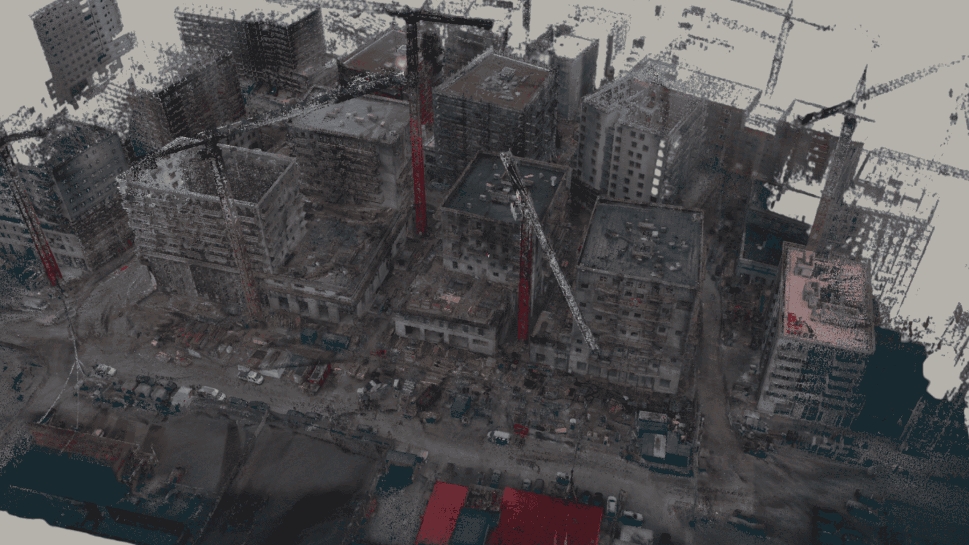
Point clouds
Detailed 3D point clouds of buildings, terrain and technical assets.
3D models
Metric 3D building models from aerial imagery and laser data.

Thermography
Radiometric thermal data to support further specialist assessment.

Condition documentation
Records of construction conditions, details and changes throughout a project.



LiDAR surveying FAQs
Typical outputs:
- LAS/LAZ or E57 point clouds
- Digital terrain models — DTM
- Digital surface models — DSM
- Elevation profiles
- Data for CAD, GIS and BIM
- Orthophotos from complementary imagery
Answers about LiDAR surveying
What is LiDAR?
LiDAR stands for “Light Detection and Ranging”. It measures distances to surfaces using laser pulses to create a spatial point dataset.
How accurate is a LiDAR survey?
Accuracy depends on the system, flight height, terrain, georeferencing and survey control. We agree the required accuracy and verification before capture.
How does LiDAR differ from photogrammetry?
Photogrammetry calculates 3D geometry from overlapping photographs. LiDAR measures distances with laser pulses and is less dependent on illumination and surface texture. The methods can complement each other.
Which areas can be surveyed?
Terrain, buildings, infrastructure, industrial assets, forests, vegetated areas and construction sites. Method suitability is assessed individually.
How quickly are results available?
On-site capture is generally completed efficiently. Depending on project scope, processing and delivery usually take place within 24 hours.
