
Drone building documentation
AeroSurvey documents roofs, façades and cornices. Structured imagery supports existing-condition records, maintenance and preparation for technical inspections. Enquire about a project in Poland, Austria or Germany.
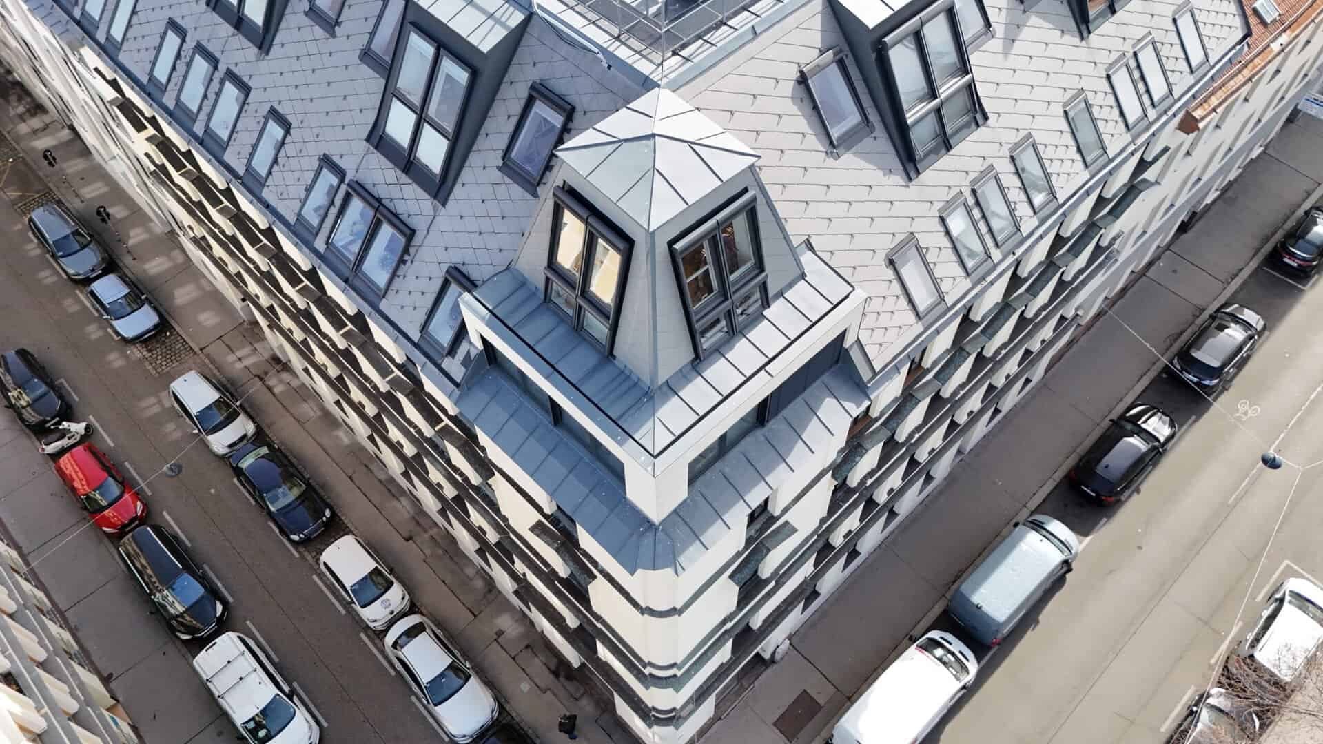
Data for records, inspections and maintenance
IMAGERY FOR PROPERTY MANAGERS AND EXPERTS
We agree capture scope and handover with the property manager or appointed specialist. Visual records support expert work; they do not independently certify technical condition or compliance with local requirements.
Capture the building envelope
We capture roofs, façades, cornices and equipment where visibility and operating conditions allow. Explore our drone building inspections.
Record visible damage
We record visible cracks, spalling, corrosion and discolouration. Capture dates and component references make observations traceable. Thermal imaging can be agreed as an additional service.
Structured building documentation
We organise images by agreed components and inspection areas so specialists can use them in reports and condition records.
Structured data handover
Depending on the agreed scope, receive organised imagery, a marked-up view or a PDF report. We tailor access and handover to the property team’s workflow.
Prepare inspections and refurbishment
TRACEABLE RECORDS OF VISIBLE COMPONENTS
Organised imagery helps locate anomalies, compare changes and agree further action with specialists.
Plan targeted follow-up checks
Imagery helps prepare inspections and records. It does not replace technical assessment, required testing or complete documents prepared by authorised professionals.
Record visible anomalies
We document visible cracks, spalling and other anomalies on cornices, roof edges and walls for further assessment.
Data for your existing workflow
Component-based image records can be incorporated into reports, assessments and planning documents. Required detail views are agreed with the technical team.
Reduce access requirements
Many exterior views can be captured without entering apartments. Required access, take-off areas and arrangements are agreed beforehand.

Building documentation in four steps
From the property address to organised deliverables: we agree scope, timing and formats with you.
Your route to structured building records
Send an enquiry
Send the property address, purpose and preferred date using our contact form.
Agree scope and receive a quote
We clarify components, access and required results. You receive a quote with an agreed scope.
On-site drone capture
We capture agreed, visible roof, façade and rooftop areas. Weather, obstacles and site conditions determine the operation.
Data and report handover
You receive organised imagery and agreed outputs for your team. The data supports condition assessment, reporting and maintenance planning.
Drone building documentation: questions and answers
How capture works, what you receive and how the data can be used.
Building documentation questions
Can the data support Vienna's Bauwerksbuch?
Images of visible building-envelope components can support a Bauwerksbuch in Vienna. This is a Vienna-specific context, not a requirement applicable in Poland. Technical assessment and preparation of required records remain with appropriately authorised professionals.
Can difficult-to-view areas be documented?
Cornices, roof edges, courtyards and rooftop equipment can often be captured from the air. Coverage depends on visibility, obstacles and local conditions. Access and necessary arrangements are clarified beforehand.
Can the data be used in technical reports?
Images are organised by agreed components and capture dates. Specialists can incorporate them into condition records and reports. Georeferencing and output formats are matched to the intended use.
What happens in unsuitable weather?
Wind, rain and visibility affect flight safety and image quality. We assess conditions before capture and agree an alternative date where needed.
How does imagery support maintenance?
High-resolution imagery records visible cracks, spalling and corrosion. Repeat capture supports comparison over time. Specialists can use the data to plan further checks and maintenance.
